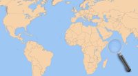
in
Mandi, India
Category:
Attraction
 1 views
  0 shares
  0 comments
 set bookmark!
Created/changed by:
System
Address details
College Rd, Batehar, Tarna, Mandi, Himachal Pradesh 175001, India
Print route »
Coordinates
N31° 42' 25" E76° 55' 54"
(31.706944444444, 76.931666666667)
 Start navigation »
Phone & WWW


Business hours
Info
Mandi State was a native state of British India, within the Punjab; with Mandi, Himachal Pradesh as its capital. The state of Mandi (the name means "market" in Hindi), which included two towns and 3,625 villages, was part of the States of the Punjab Hills. It was located in the Himalayan range, bordering to the west, north, and east on the British Punjabi district of Kangra; to the south, on Suket; and to the southwest, on Bilaspur. As of 1941, population of Mandi State was 232,598 and area of the state was 1,139 square kilometres (440 sq mi).
 1 views
  0 shares
  0 comments
 set bookmark!


